


Anatone Voting District, Asotin County, Washington
About
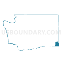
Outline

Summary
| Unique Area Identifier | 683403 |
| Name | Anatone Voting District |
| County | Asotin County |
| State | Washington |
| Area (square miles) | 271.61 |
| Land Area (square miles) | 271.61 |
| Water Area (square miles) | 0.00 |
| % of Land Area | 100.00 |
| % of Water Area | 0.00 |
| Latitude of the Internal Point | 46.15020950 |
| Longtitude of the Internal Point | -117.13129600 |
Maps


Graphs
Select a template below for downloading or customizing gragh for Anatone Voting District, Asotin County, Washington


Neighbors
Neighoring Voting District (by Name) Neighboring Voting District on the Map
- Asotin 2 Voting District, Asotin County, WA
- Rural Asotin Voting District, Asotin County, WA
- Water: Grande Ronde River, Asotin County, WA
- Water: Snake River, Asotin County, WA
- Water: Snake River - Asotin, Asotin County, WA
- West Asotin Voting District, Asotin County, WA